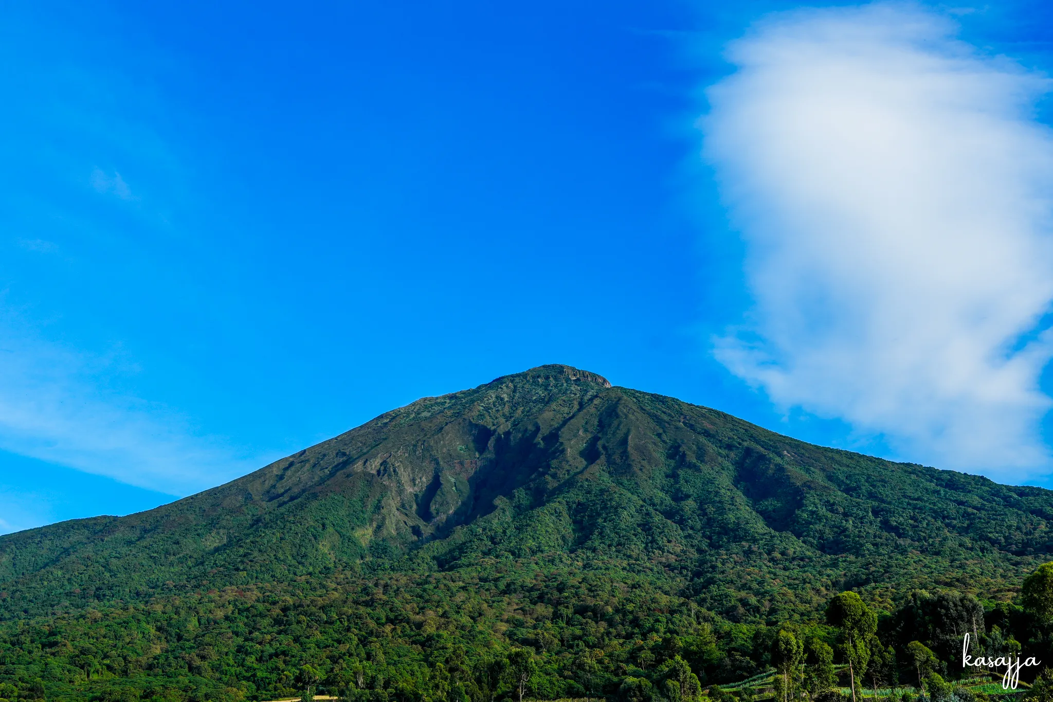
Mount Muhabura is a steep volcanic giant that rewards persistence with huge views across Uganda and Rwanda.
Mount Muhabura, also known as Mount Muhavura, is one of the three Virunga volcanoes that can be climbed from Uganda. Standing at 4,127 metres, it is the highest of the three Ugandan Virungas and sits on the border between Uganda and Rwanda. Unlike Gahinga, which feels more forgiving, Muhabura is a serious climb from the moment you leave the car. The mountain rises steeply almost immediately, and there are very few sections where the trail gives you a real break.
The name Muhabura means "the guide" or "the one who guides", which makes a lot of sense when you see the mountain from a distance. Its huge volcanic cone stands prominently above the surrounding landscape and can be seen from far away. The mountain is shared by Uganda and Rwanda, meaning it can be climbed from either country. From the Ugandan side, the trail begins at Mgahinga Gorilla National Park and takes you steadily upwards through changing vegetation before reaching the higher, more open sections of the mountain.
One thing I always remember about Muhabura is the stairs. There are two main resting huts along the route, one around 2,500 metres and another around 3,850 metres, but apart from those breaks, the climb keeps going. The higher you get, the more demanding the mountain becomes, and from the second hut there are long sections of stairs leading towards the summit. This is where the famous "DON'T GIVE UP" signs along the trail become very useful. They almost feel like they were put there specifically for the moment when your legs are telling you to turn around.
The summit is the reward for all that climbing. At the top, there is a crater that holds a small lake, and on a clear day the views are incredible. You can see across the Virunga landscape, with Gahinga and Sabyinyo nearby, while Rwanda and Uganda stretch out below you. Because Muhabura is a standalone volcanic cone, the feeling of looking down from the summit is very different from climbing through a mountain range like the Rwenzori. You have spent hours climbing almost continuously upwards, and suddenly you are standing above an enormous landscape.
Muhabura is a mountain that tests resilience more than anything else. You don't need technical climbing skills to reach the summit from the standard Ugandan route, but you do need good preparation, patience and the willingness to keep moving when the mountain starts getting into your head. The steepness begins almost immediately and stays with you for most of the climb. But that is also what makes standing at 4,127 metres so satisfying. You know exactly how much effort it took to get there. Muhabura doesn't give its summit away easily, and when you finally reach it, you know you've earned it.