
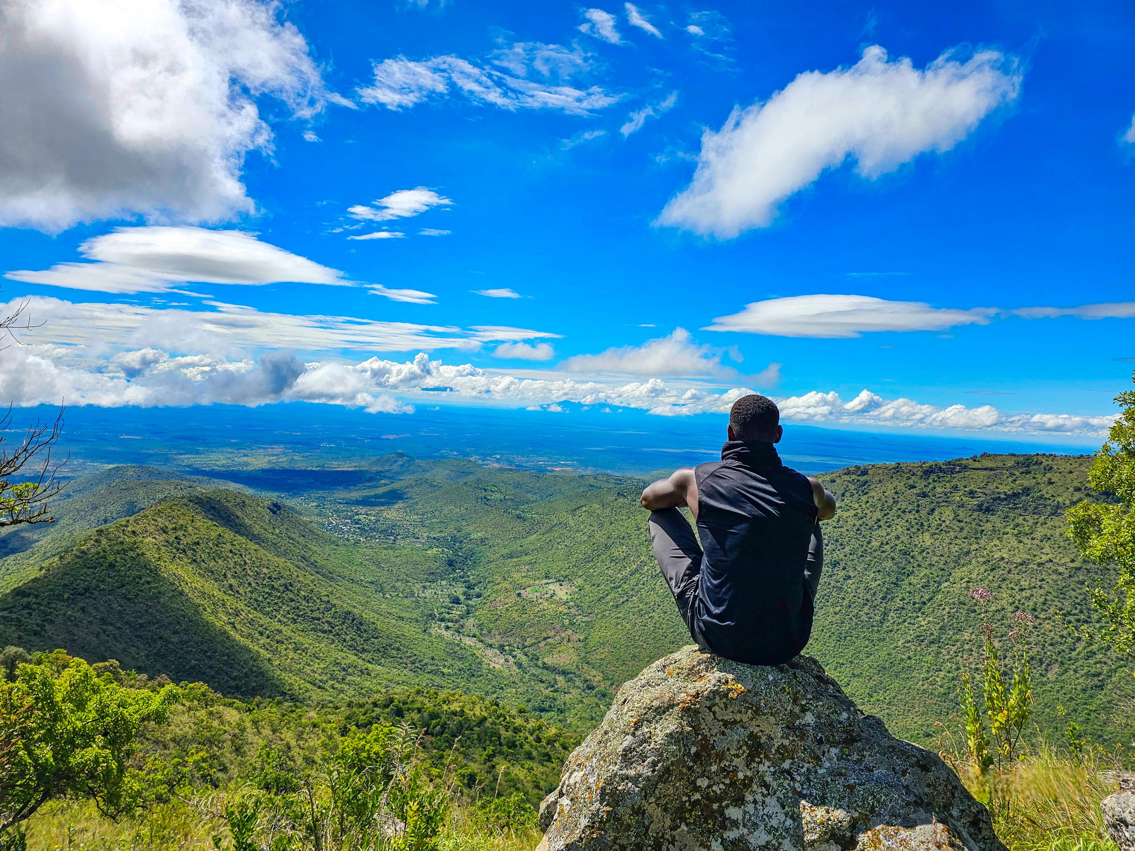
Karamoja is not what you were taught. Discover the mountains, people and wild landscapes that make this one of Uganda’s most unexpected adventures.
Growing up in Uganda, many of us were taught that Karamoja was a desert.
That was the picture I had in my head too. Dry land, dust, thorny bushes, cattle and a place that felt completely different from the Uganda I knew.
Then I went to Karamoja.
And honestly, I realised very quickly that we had been missing the bigger picture.
Karamoja is one of the most beautiful parts of Uganda.
There is something about driving through those endless plains and suddenly seeing a huge mountain rising out of the landscape. The sunsets feel different, the landscape feels almost endless, and the mountains give the whole region a character that you simply don't find anywhere else in Uganda.
Yes, Karamoja is semi-arid and experiences long dry periods. But calling it a desert doesn't come close to telling the whole story.
There are mountains, forests, wildlife, rivers, plains, cattle, communities, traditions and some incredible landscapes.
And if you're a mountain person, there is a lot more to Karamoja than most people realise.
KARAMOJA IS MORE THAN JUST MOUNTAINS
Before we talk about the peaks, we have to talk about the people.
Karamoja is home to several communities, including the Karimojong, Jie, Dodoth, Tepeth, Ik and others. The region has a strong pastoral heritage, with cattle playing an important role in the social and economic life of many communities.
For generations, people here have had an incredibly close relationship with the land. They understand the seasons, the water sources, the grazing areas and the mountains in ways that someone visiting for a few days simply cannot.
And this is one of the things I love about travelling through Karamoja.
You don't just come here to climb a mountain.
You are entering a landscape with its own history, culture, traditions and way of life.
The mountains are part of that story too. They have provided water, forests, grazing areas and homes for communities living around and on their slopes.
So when you climb a mountain in Karamoja, you are not simply climbing a mountain.
You are walking through someone's home.
THE FOUR MOUNTAINS OF KARAMOJA
When we talk about the mountains of Karamoja, four names stand out: Mount Moroto, Mount Kadam, Mount Napak and Mount Morungole.
They are all different, and that is what makes exploring them so interesting.
Some are higher. Some are steeper. Some are more remote. Some have more exposed rock. Some have a much stronger cultural experience attached to them.
And none of them should be judged by elevation alone.
1. MOUNT MOROTO
Location: Moroto District Highest point: Approximately 3,083m Typical duration: 1–3 days depending on the route and peaks Elevation gain: Can exceed 1,300m depending on the starting point and route Terrain: Rocky slopes, open plains, forest, ridges and exposed rock Difficulty: Challenging to Difficult Best season: December–February and June–August
If Karamoja had a mountain that introduced itself before anything else, it would probably be Moroto.
Mount Moroto rises dramatically from the plains and sits right beside Moroto town. Its highest point, commonly referred to as Sokodek Peak, is around 3,083 metres above sea level.
What makes Moroto interesting is the contrast.
You can look around and see the dry, open plains of Karamoja, then look up and realise that you're about to climb more than 3,000 metres.
The mountain is also closely connected to the Tepeth people who live on its slopes, and the landscape changes considerably as you gain elevation.
But don't let the elevation fool you.
The heat at the lower sections, combined with the elevation gain, rocky terrain and long hiking hours, can make Moroto a serious climb.
Start early. The Karamoja sun does not play around.
2. MOUNT KADAM
Location: Nakapiripirit District Highest point: Approximately 3,063m Typical duration: 2 days / 1 night Elevation gain: Approximately 1,500m depending on the route Terrain: Farmland, forest, steep slopes, rocky sections and exposed upper sections Difficulty: Difficult Best season: December–February and June–August
Mount Kadam is one of the highest mountains in Karamoja and rises to approximately 3,063 metres.
Unlike a simple day hike, Kadam is more of an expedition experience. A typical climb takes two days, with camping on the mountain before continuing towards the summit.
The lower sections take you through farmland and forest before the terrain becomes increasingly steep and rocky.
As you get higher, the landscape becomes more exposed and demanding.
Kadam is a mountain where you need to respect the distance as much as the elevation. You are spending two days moving through difficult terrain, and that means your preparation needs to go beyond simply being able to walk uphill.
This is a proper mountain expedition.
3. MOUNT NAPAK
Location: Napak District Highest point: Approximately 2,530m Typical duration: Around 10–12 hours for a full summit attempt Elevation gain: Approximately 1,200–1,300m depending on the route Distance: Around 19km for a published summit route Terrain: Rocky slopes, steep sections, bush, cliffs and exposed rock Difficulty: Difficult Best season: December–February and June–August
Mount Napak is lower than Moroto and Kadam, but this is one of those mountains where elevation doesn't tell the whole story.
The mountain rises out of the Karamoja plains and has steep, rocky sections, cliffs and areas where you have to scramble.
And then there is the heat.
Karamoja can be extremely hot, particularly around the lower sections, so starting early and carrying enough water are extremely important.
The terrain is another challenge. There are sections where the trail becomes less of a trail and more of a route across rocks.
Some of these rocks can be completely exposed, steep and surprisingly smooth.
When conditions are wet, they can become even more difficult.
Depending on the route and conditions, ropes may even be used during descent to help climbers negotiate some of the more exposed and smooth rock sections safely.
This is why I always tell people not to judge these mountains simply by their height.
You don't need to be above 4,000 metres to have a serious mountain.
4. MOUNT MORUNGOLE
Location: Kaabong District / Kidepo Valley area Highest point: Approximately 2,749m Typical duration: Approximately 8–13 hours depending on the route and objective Terrain: Savannah, rocky slopes, forest and long gradual sections Difficulty: Challenging Best season: December–February and June–September
Then there is Mount Morungole, further north in the Karamoja landscape and closely associated with the Ik people.
The mountain rises to approximately 2,749 metres and sits within the wider Kidepo Valley landscape.
Morungole is different because the mountain experience is deeply connected to culture.
The slopes are home to the Ik, one of Uganda's smaller and more geographically isolated communities. The mountain and surrounding landscape are an important part of their way of life.
This means climbing Morungole can be about much more than reaching a summit.
You are moving through a landscape where people have lived and built their communities for generations.
The terrain can be steep, rocky, bushy and physically demanding, but the views are incredible. As you gain elevation, the landscape opens up and you begin to see the vastness of Karamoja and the Kidepo Valley area from above.
And with Morungole, the cultural experience is just as important as the mountain itself.
THE ROCKS ARE PART OF THE CHALLENGE
This is probably one of the most important things climbers need to understand about the mountains of Karamoja.
Don't look at the elevation and assume these are easy mountains.
There are sections of completely open rock.
I'm talking about places where you are no longer walking on a nice, defined trail. You're moving across exposed rock surfaces, sometimes steep and sometimes incredibly smooth.
When the rocks are dry, they already require concentration. When they are wet, things can become a completely different story.
On some sections, especially during descent, we may even use ropes to help climbers move safely because of how exposed, steep and smooth the rocks can become.
This is where experience and good guiding really matter.
A mountain can be only 2,500 or 3,000 metres high and still be technically demanding because of the terrain.
Elevation is only one part of the story.
WHAT IS THE TERRAIN LIKE?
The terrain is one of the things that makes Karamoja so interesting.
You can begin in the vast open plains, with the mountain rising in front of you, and then watch the landscape change as you gain elevation.
Depending on the mountain, you can encounter dry open ground, bush, forest, steep slopes, loose rocks, exposed rock faces and scrambling sections.
Some parts are straightforward walking.
Others will have you slowing down, using your hands and carefully choosing every step.
And then there are the views.
Because Karamoja is so open, gaining elevation gives you an incredible perspective of the landscape. You can look back and see the plains stretching for what feels like forever.
You climb the mountain, but the real reward is seeing Karamoja from above.
WHEN IS THE BEST TIME TO CLIMB?
Karamoja has a semi-arid climate, and the timing of your expedition matters.
The main rainy period generally runs from April to August, while the region experiences a hotter and drier period roughly from November to March.
For mountain climbing, the drier months generally make trails and access roads easier to navigate.
A good general guide is December to February, when conditions are typically drier, although temperatures can be high.
March is a transition period and conditions can begin changing as the rains approach.
April to August generally brings more rainfall, which can make trails, roads and exposed rock more difficult.
September and October can be transitional months, with conditions varying from year to year.
November generally marks the return towards hotter and drier conditions.
However, Karamoja's weather can vary, so always check the current conditions before an expedition rather than relying only on the calendar.
And remember, dry season doesn't mean easy season.
It can also mean very hot.
WHAT CLIMBERS NEED TO KNOW BEFORE COMING
If you're planning to climb any of these mountains, don't just look at the summit elevation.
Look at the elevation gain, distance, terrain, heat, exposure, remoteness and expected time on the mountain.
A mountain that is 2,500 metres high can still involve more than 1,200 metres of climbing.
A route that looks short on a map can take 10 or 12 hours.
A section that looks easy in a photograph can become extremely difficult when you're standing on smooth exposed rock.
And the heat is another factor that visitors sometimes underestimate.
Start early, carry enough water, wear proper hiking footwear, protect yourself from the sun and follow your guide's instructions, particularly on exposed rock.
You should also be prepared for limited infrastructure in some areas. These are not city hikes where help is always a few minutes away.
Preparation matters.
KARAMOJA IS NOT A DESERT
Maybe this is the biggest thing I want people to take away from this article.
Yes, Karamoja is semi-arid.
Yes, parts of it are incredibly dry.
Yes, the heat can be intense.
But Karamoja is not the empty desert many of us imagined when we were growing up.
It is mountains, plains, forests, wildlife, cattle, communities, stories, culture and some of the most incredible landscapes Uganda has to offer.
And perhaps that is what makes it so special.
You can spend one day looking at a mountain from the middle of a huge savannah, and the next day find yourself climbing through a completely different environment.
WHY YOU SHOULD EXPLORE THE MOUNTAINS OF KARAMOJA
I think Uganda has become very good at talking about a few famous destinations while forgetting just how much is sitting outside the usual tourist routes.
Karamoja is one of those places.
For a mountain lover, it offers something completely different from the Rwenzori, Elgon or the Virungas.
The mountains may not always have the highest elevations, but the combination of terrain, heat, remoteness, culture and landscape creates an experience of its own.
And once you have seen Karamoja from the top of one of its mountains, you start to understand why I keep going back.
Karamoja isn't the desert we were taught.
It is a land of mountains, culture, people and some seriously beautiful landscapes.
COME SEE KARAMOJA FOR YOURSELF
The best way to understand Karamoja is not through a classroom, a photograph or a story someone told you.
Go there.
Drive through the plains. Meet the communities. Listen to the stories. Spend time with local guides. Then put on your hiking shoes and climb one of the mountains.
You might arrive thinking you are going to climb a mountain.
You might leave feeling like you discovered an entirely different Uganda.
Ready to experience this yourself?
View Expedition Calendar